


CartoDruid – GIS-Offline-Tool
Beschreibung von CartoDruid – GIS-Offline-Tool
CartoDruid ist eine GIS-Anwendung, die vom Instituto Tecnológico Agrario de Castilla y León (ITACyL) entwickelt wurde und als Werkzeug zur Unterstützung der Feldarbeit konzipiert ist. Es befasst sich mit der Herausforderung der Offline-Bearbeitung georeferenzierter Informationen.
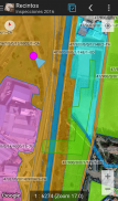
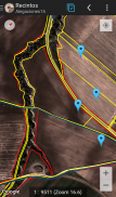
In vielen Feldgebieten mit unzureichender Mobilfunkabdeckung bietet CartoDruid eine zuverlässige Lösung, indem es die Visualisierung der auf dem Gerät gespeicherten Raster- und Vektorebenen ermöglicht. Es ermöglicht die Erstellung neuer Geometrien (Elemente), indem diese direkt auf dem Bildschirm gezeichnet oder eingebettetes oder externes GPS verwendet werden.
CartoDruid ist benutzerfreundlich und erfordert keine GIS-Vorkenntnisse, sodass es für jeden, der Feldarbeitsinformationen verwaltet, einfach zu konfigurieren und zu verwenden ist. Die generierten Daten können zur Verwendung in externen Anwendungen exportiert werden.
Zu den Funktionen von CartoDruid gehören:
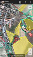
Visualisierung von Online-Google Maps.
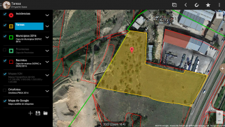
Verwendung vektorieller Kartographie in einer SpatiaLite-Datenbank.
Unterstützung für Rasterbilder aus einer RasterLite-Datenbank.
Verbrauch von Online-WMS-Diensten.
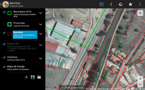
Erstellung und Konfiguration neuer Layer auf dem Gerät.
Filter-, Symbologien-, Beschriftungs-, Such- und Identifikationsformulare basierend auf SQL-Abfragen.
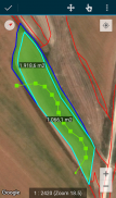
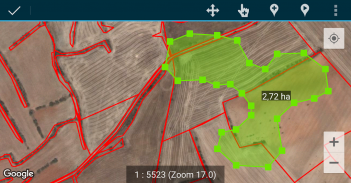
Bearbeiten von Attributen und manuelles Zeichnen von Geometrien.
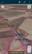
GPS-basiertes Zeichnen und Bearbeiten von Geometrien.
Erweiterte Werkzeuge zur Geometriebearbeitung.
Funktionen zur Datenspeicherung, einschließlich georeferenzierter Daten und der Zuordnung von Bildern zu Entitäten.
Zusätzliche Tools wie SIGPAC-Suche, Messtools, Navigationshilfen, Lesezeichenverwaltung.
Import- und Exportfunktionen in mehreren Formaten.
TOC-Verwaltung und SHP-Dateiunterstützung als experimentelle Funktion.
Steuerelemente für Ebenenoperationen.
CartoDruid nutzt Hintergrundstandortdienste zum Erstellen von Funktionen basierend auf der Standortverfolgung. Der Benutzerstandort wird nur zum Erstellen von Geometrieeckpunkten oder zur Kartenpositionierung verwendet, wobei die Daten lokal gespeichert und nicht außerhalb des Geräts gesendet werden. Das Löschen von Projektordnern ermöglicht eine einfache Datenentfernung.
Eine vollständige Liste der Funktionen, herunterladbare Beispiele und Startanleitungen finden Sie unter www.cartodruid.es.
CartoDruid – GIS-Offline-Tool – Version 0.63.2
(29-05-2025)CartoDruid – GIS-Offline-Tool – APK Informationen
APK Version: 0.63.2Paket: es.jcyl.ita.crtdrdNeueste Version von CartoDruid – GIS-Offline-Tool
Weitere Versionen


 4.71
4.71


 4.34
4.34


Apps in derselben Kategorie


Das könnte dir auch gefallen...


